KARACHI: ER Report
Of the six strategic canals, I believe the Cholistan Canal may be the most harmful for Sindh, says Naseer Memon, a known researcher on irrigation water resources in Pakistan.
The history of Cholistan Canal is over a century old, and old documents suggest that the water availability was exaggerated even back then. An English engineer had raised objections about the data on water availability. Thus, the history of inaccurate or falsified statistics is longstanding, he claimed in a program organized by diaspora Sindhis Association of North America (SANA) in Karachi.
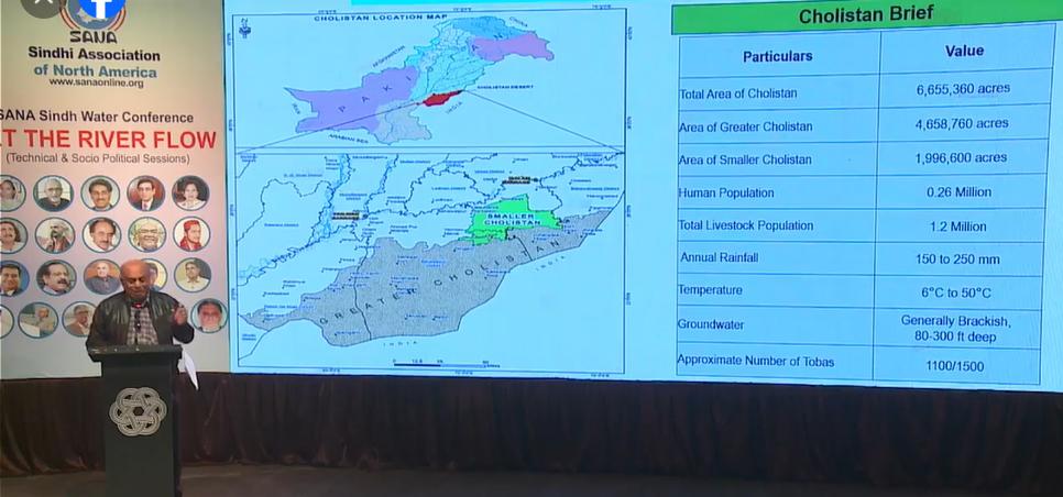
Cholistan Canal
The canal command area of the Cholistan Canal and its connecting canals covers 6.6 million acres (including the Greater Thal Canal). How will they irrigate such a large area? The strategic canal plan includes Phase I of the smaller Cholistan Canal. The real scheme involves the Greater Cholistan Canal followed by the smaller Cholistan Canal, with Phase I as a precursor. The capacity of this canal is 4000 cusecs, drawing water from the Sulemanki Barrage on the Sutlej River. A 120-kilometer-long canal will connect to it. The total length of this project is 176 kilometers. In Phase I, 452,000 acres of land would be irrigated. Three small dams are also included in the plan on the Chenab River. Additionally, there are two barrages on the Sutlej River: Haselpur and Bahawalnagar. It’s important to note that the Indus River is not alone; its system includes all these rivers.
Why Are We Worried About the Cholistan Canal?
They claim the canal is on the Sutlej River. However, it is actually on the Indus River because the Sutlej is a dry river. It is one of the three rivers that Pakistan handed over to India under the Indus Basin Treaty. Officially, there is no water in the river, and India is not under any obligation to allow water to flow. If there is a need for water, it will have to be transferred from the Indus River, as the Sutlej doesn’t have any water. No such large project should be launched on a dry river. Therefore, the water will be transferred from the Jhelum River to the Chenab, then to the Ravi, and from the Ravi to the Sutlej through link canals. When water is transferred through the link canal, there will be a shortage in the command area of the Jhelum River, and water from the Indus will be diverted through link canals connecting the Indus with the Jhelum. Thus, the project is indirectly connected to the Indus, and this is a major concern.
The Myth of Surplus Water
We believe there is no surplus water in the system. From 1976 to 1999, the average flow below the Indus was 40 million acre-feet (MAF), and if we calculate the flows from 1999 to 2024, the average flow downstream of Kotri has been 14 MAF. How can such huge projects be launched under these conditions? In fact, we are facing a shortfall of 35 MAF today, especially when considering our commitments. – KARACHI: ER Report

